Guides
Language
EnglishCurrency
US dollar · $Your currency applies on GetYourGuide too.
Guide · The island
Tavolara: a mountain standing in the sea
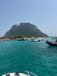
Tavolara Island rises straight out of the water off north-east Sardinia, a block of pale rock that you see from almost every beach between Olbia and San Teodoro. Here is what it is, how to reach it and what you may do there.
Editorial team, tavolaraboattour.comUpdated October 20, 20266-minute read51 sources
Quick answer
- 01What it is
- A limestone and granite mountain rising from the sea, 560 m high and 4 km long.1
- 02Where
- Off north-east Sardinia, in Olbia's territory, with Porto San Paolo facing it on the mainland.2
- 03Getting there
- Ferries run daily from Porto San Paolo; some private boats leave Olbia and Golfo Aranci.34
- 04Where you land
- Spalmatore di Terra, with a little port, places to eat and a few houses.5
Where is Tavolara, and what kind of island is it?
Tavolara sits off the north-east coast of Sardinia and belongs to Olbia's municipal territory together with its smaller neighbours Molara and Molarotto.8 On the mainland directly opposite lies the village of Porto San Paolo, from which most boats cross.2 Seen from the coast it looks like a table set on the sea, flat on top and sheer at the sides.
Italians call it Isola di Tavolara, and the regional tourism board describes it as a limestone and granite mountain 560 metres high and four kilometres long.1 Olbia's own tourism portal gives the same height and picks it out as the landmark of the protected sea around it.9 The protected area's managers set its pale, vertical limestone against the rounded granite of Molara, Molarotto, Piana and the Isola dei Cavalli.10
All of these islands lie inside the Tavolara Punta Coda Cavallo Marine Protected Area, about 15,000 hectares of sea and roughly 40 km of coast.11 That status shapes your visit more than anything else: where boats may go, where you may swim and anchor, and what you may take home, which is nothing at all.
History in brief
From a sandbar island to a protected area
-
8,000 years ago
Cut off by the sea
Tavolara became an island, probably still joined to Isola Piana.12
-
7,000 years ago
First people
Neolithic seafarers traded Sardinian obsidian along this coast.13
-
1600s
The Bertoleoni arrive
A family of shepherds settles, by the protected area's account.14
-
Until 1955
Lime kilns
Kilns burned the island's limestone; their ruins are still visible.15
-
1961
NATO base
Built at Punta Timone; the last residents leave.6
-
1997
Protected area
The Marine Protected Area is established by decree.16
Limestone, granite and a sandbar
The island's two rocks tell its story. The limestone was laid down in the Jurassic, and water has been dissolving it ever since, opening caves and fissures; the large arch near the old lighthouse is what remains of an ancient cave.17 The granite is older, about 300 million years, and on Tavolara it appears only at the Spalmatore di Terra and in a few outcrops along the coast.18
Tavolara has not always been an island. Fossil beaches and other deposits show that it became one only 8,000 years ago, and a sandy strip called the Passetto still joins the last part of the Spalmatore di Terra to the main mass.12 The first people reached this coast in the Neolithic, about 7,000 years ago, when it lay on the sea route of the Sardinian obsidian trade.13
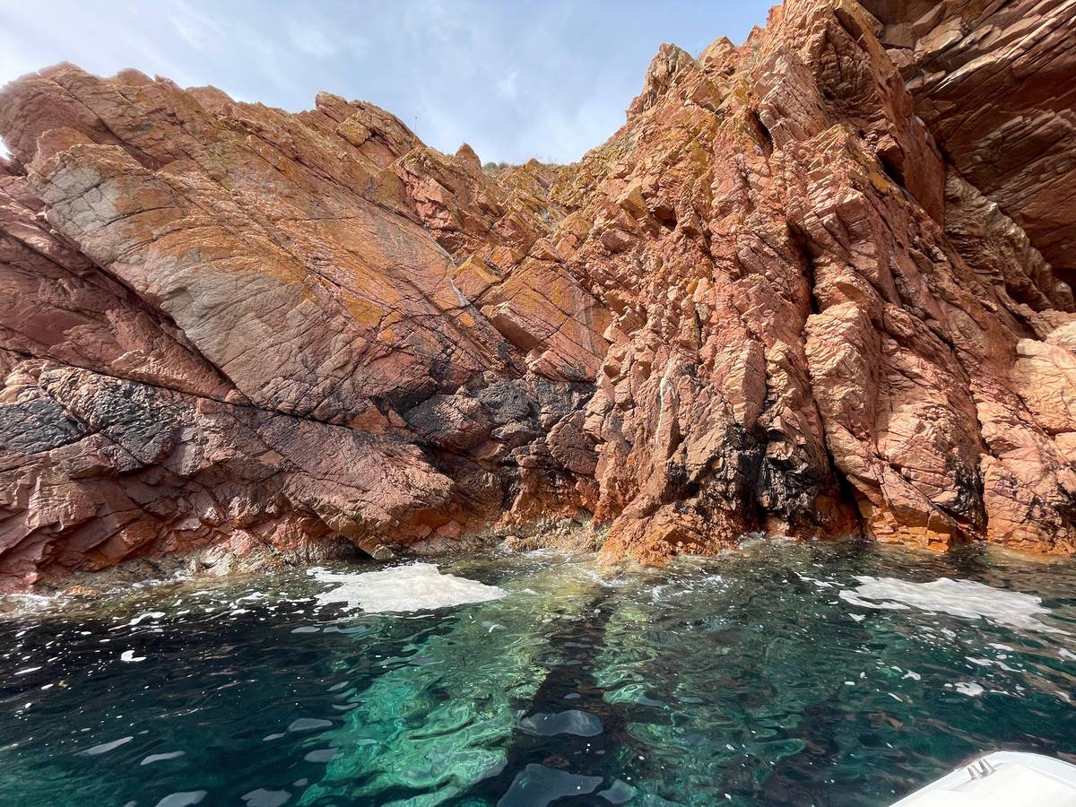
You notice the geology from a boat even if you never read about it. The limestone walls drop almost straight into deep blue water, while the granite coves of Molara and the mainland shelve gently into turquoise shallows. Boat tours here mix the two: cliffs for the view, granite pools for the swim.
Three islands
Tavolara, Molara and Molarotto compared
| Tavolara | Molara | Molarotto | |
|---|---|---|---|
| Main rock | Limestone and granite | Granite | Granite |
| Size | 560 m high, 4 km long | Second largest | A small rock |
| People | A few houses | Uninhabited | Integral reserve |
| Landing | Spalmatore di Terra | Boats anchor off the pools | No landing |
| Wildlife | Shearwater colonies | Wild cows and goats | Its own lizard |
From the protected area, SardegnaTurismo and the MPA services map.11920212223
Decision helper
How do you want to meet the island?
Choose what matters most on your day
Daily crossings from Porto San Paolo land you at the Spalmatore.3
This site's tour swims off Tavolara and at Punta Spalmatore.
A via ferrata of about 45 minutes leads to Punta Cannone; check it runs under the 2025 climbing ban.24
Tours leave the MOYS marina in Olbia.
Tavolara is a limestone and granite mountain that rises up from the sea, 560 metres high and four kilometres long
Spalmatore di Terra: the place you land
Boats land at the Spalmatore di Terra, which has a little harbor, places to eat and a small group of houses.5 Its sand faces the Sardinian coast, and a smaller docking area on the far side, at Cala Levante, serves the lighthouse and the NATO radio station.27
In summer the protected area runs an information point here, where visitors find advice on how to behave inside the reserve.28 Its services map also marks two nature trails at the landing, the paths of the Prolago and the Mandria.29 Carry your rubbish home: one boat operator reminds guests that there is no waste collection service on the island.
Walking is limited to part of the island. A historian of Tavolara writes that visitors move freely on the land owned by the Bertoleoni descendants, while other owners and the Italian state restrict access to theirs.30 Stay on marked paths, carry water and expect little shade away from the beach. The landing area is the busy part of the island on a summer day, with boats coming and going and swimmers on the sand, so a walk along the trail is the easiest way to find a quieter corner and a view back towards the mainland.
Map
Tavolara, Molara and the coast from Olbia to San Teodoro
Where the boats leave from, the islands and their landing places, and the beaches that face them.
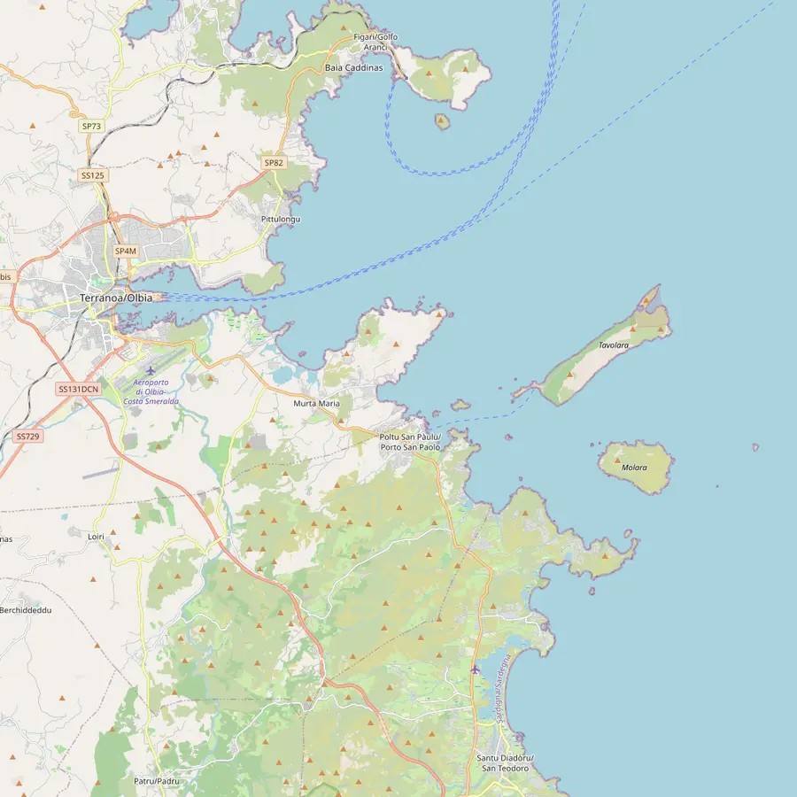 1Olbia marina2Golfo Aranci3Figarolo4Porto San Paolo5Tavolara6Molara7San Teodoro8Capo Ceraso
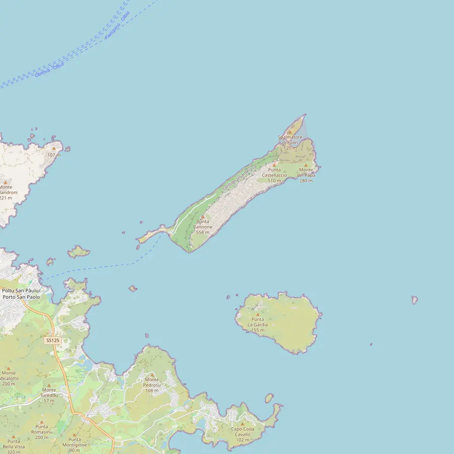 9Spalmatore di Terra10Punta Cannone11Punta Timone12Piscine di Molara13Molarotto14Isola Piana15Isola dei Cavalli
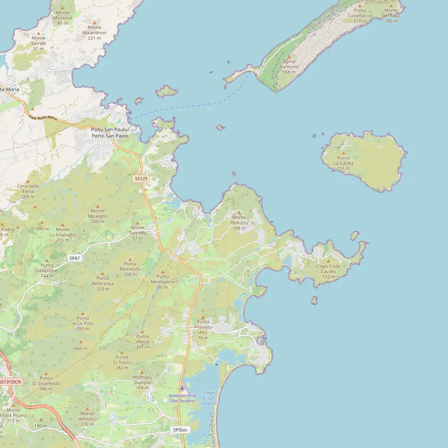 16Spiaggia del Dottore17Porto Istana18Porto Taverna19Cala Girgolu20Cala Brandinchi21Lu Impostu22Capo Coda Cavallo23La Cinta
- 1Olbia marina (MOYS)
This site's tour checks in here at Dock A, Berth A44, and several other boats to the islands leave from the same marina.
In Google Maps ↗ - 2Golfo Aranci
A port 20 minutes from Olbia, facing Tavolara, where dolphin trips and some island boats start.31
In Google Maps ↗ - 3Figarolo
A pyramid-shaped limestone islet off Cala Moresca, where the dolphin trips look for a pod of bottlenose dolphins.32
In Google Maps ↗ - 4Porto San Paolo
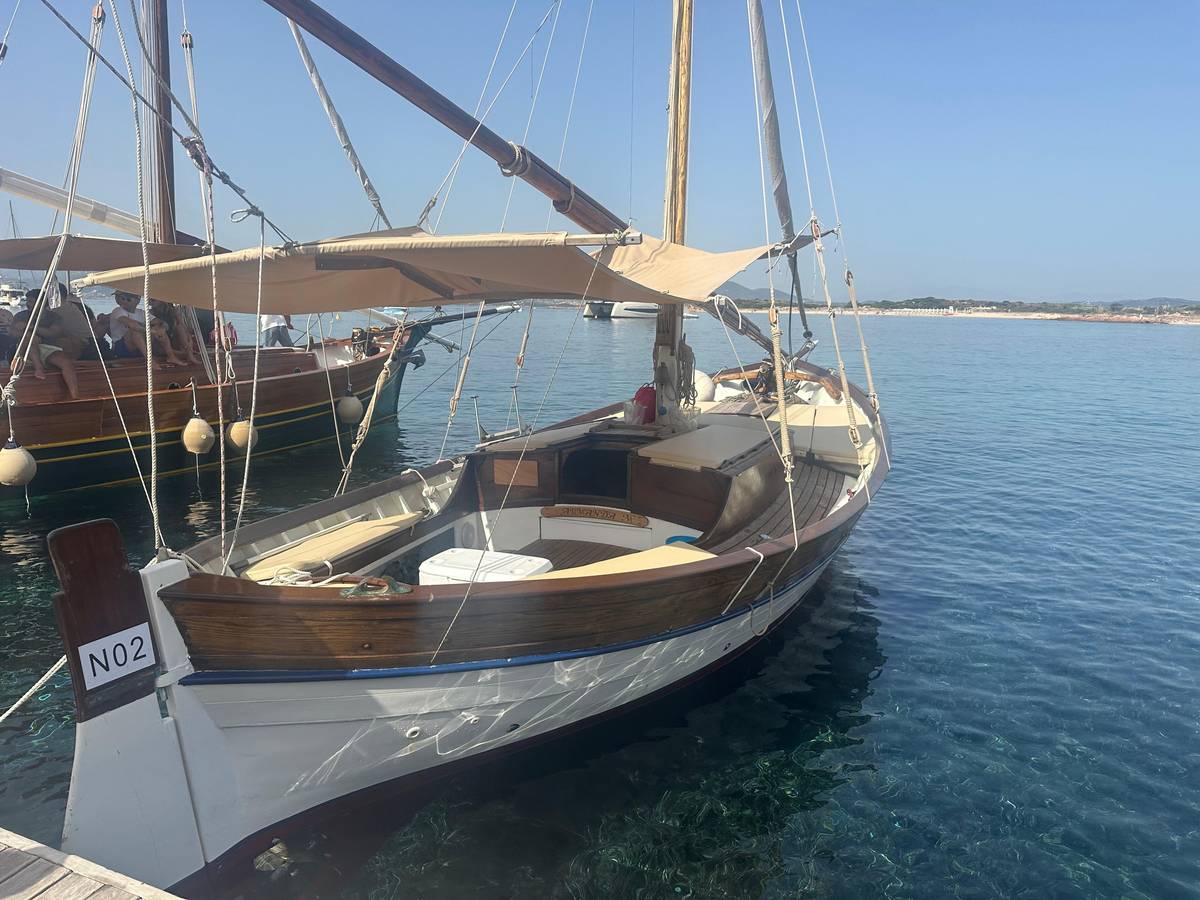
The village opposite the island: the ferry office is in Via Molara, and wooden boats leave from the floating docks.33
In Google Maps ↗ - 5Tavolara
A limestone and granite mountain rising from the sea, 560 m high and 4 km long, in Olbia's territory.12
In Google Maps ↗ - 6Molara
The second largest island of the protected area, uninhabited, with its pools on the south-west side.1934
In Google Maps ↗ - 7San Teodoro
The harbor where the dinghy tours of the archipelago set off each morning.
In Google Maps ↗ - 8Capo Ceraso
A headland passed on the way out from Olbia; a disused military road leads to its old fortifications.35
In Google Maps ↗ - 9Spalmatore di Terra
The landing place, with a little port, places to eat, a few houses and the protected area's info point.529
In Google Maps ↗ - 10Punta Cannone
The summit, reached by a guided trek and a short via ferrata; climbing on the island has been restricted since 2025, so ask the operator first.
In Google Maps ↗ - 11Punta Timone
Site of the NATO radio station built in 1961; the protected area's map marks a military area with no entry.67
In Google Maps ↗ - 12Piscine di Molara
Clear pools among granite rocks, with an anchoring zone for boats up to 30 m.3422
In Google Maps ↗ - 13Molarotto
A small granite rock in the integral reserve, home to a lizard subspecies found nowhere else.21
In Google Maps ↗ - 14Isola Piana
An island off Porto San Paolo with little beaches of fine greyish sand.36
In Google Maps ↗ - 15Isola dei Cavalli
A small island with a beach of fine, firm sand and shallow water.37
In Google Maps ↗ - 16Spiaggia del Dottore
The first swim stop of this site's tour and of several other boats.
In Google Maps ↗ - 17Porto Istana
A bay of four beaches at the foot of Capo Ceraso, twenty minutes by car from Olbia.38
In Google Maps ↗ - 18Porto Taverna
Dunes with a pond behind them, where water birds can be seen.39
In Google Maps ↗ - 19Cala Girgolu
Known for the turtle-shaped rock called La Tartaruga.40
In Google Maps ↗ - 20Cala Brandinchi
Very light sand and turquoise water almost opposite the island; access is booked from 1 June to 30 September.2641
In Google Maps ↗ - 21Lu Impostu
One kilometre of white sand dunes with junipers, the twin of Brandinchi.42
In Google Maps ↗ - 22Capo Coda Cavallo
A strip of granite land sheltered by Tavolara, with Molara and the islet of Proratora in front.43
In Google Maps ↗ - 23La Cinta
San Teodoro's most famous beach, an arch of fine white sand facing the island.25
In Google Maps ↗
Checklist
On the island
Bring
- Water: there is little shade away from the beach
- A bag to carry your rubbish home
- Sun hat and sunscreen
Remember
- The military zone is closed to visitors
- Climbing is banned, except guides on study trips
- Stay on marked paths
Video
We Sailed to the Smallest Kingdom in the World: Tavolara Island (in Italy) 👑
Nothing loads from YouTube until you press play.
The summit, the cliffs and the climbing ban
Most of Tavolara is steep rock, and its top is not a casual walk. A guided trekking on Tavolara listed on GetYourGuide crosses by dinghy from Porto San Paolo, walks about 2 hours from the island's small port and then climbs a short via ferrata of about 45 minutes to Punta Cannone. The route is 7 km with 600 m of height difference and is graded for experienced hikers with equipment.
Ask the operator whether the via ferrata is running before you book, because climbing on the island is now restricted. In 2025 the Comune di Olbia adopted an ordinance that bans climbing on Tavolara except for qualified mountain guides with a sport-climbing specialisation, and only for study and science.24 The town cited a survey that found high and very high landslide hazard on all of the island's slopes.44
For most visitors the cliffs are best seen from the water. Boats run slowly under the walls, and from a deck you can follow the layers of rock and spot seabirds on the ledges. Half of the world's Yelkouan shearwaters breed in the caves of Tavolara and Molara, so the cliffs matter far beyond Sardinia.23
Punta Timone and the military zone
The north-eastern tip of the island is closed to visitors.45 In 1961 a NATO military base was built at Punta Timone, and the last residents had to leave Tavolara because of it.6 The Ministry of Defence still lists a Navy unit called the Stazione VLF NATO Tavolara.46
The protected area's map marks a military area with no entry, under an ordinance of Olbia's Coast Guard from 1967.7 A Navy engineering report puts the station's facilities in the north-east of the island and states that tourists and bathers may not enter the zone or approach it by any means.4547
In practice this changes little for a boat day. Tour boats keep to the open coast, the landing and the swim spots, and skippers know where the line runs. If you hire a boat yourself, ask the rental company to show you the restricted water on a chart before you leave, and keep well clear of it. Keep drones and long camera lenses away from the installations, and save your photographs for the cliffs, the clear water below them and the people on your boat.
How to see Tavolara
The simplest crossing is from Porto San Paolo, where ferry services leave every day for Tavolara and the smaller islands.3 Some private boats also start from Olbia and Golfo Aranci.4 On a ferry you land at the Spalmatore and choose your own return; on a tour you see more of the coast but usually spend less time ashore.
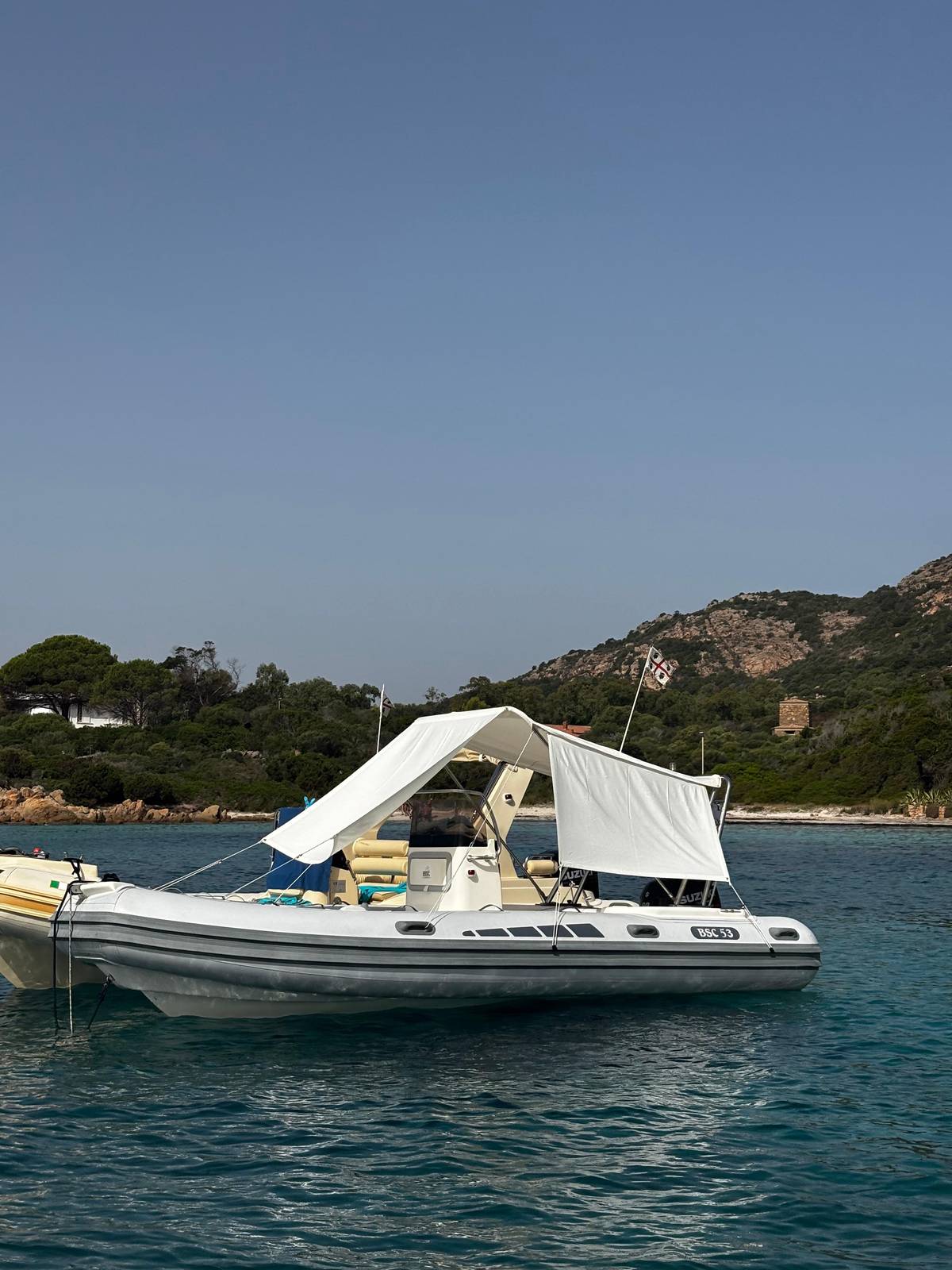
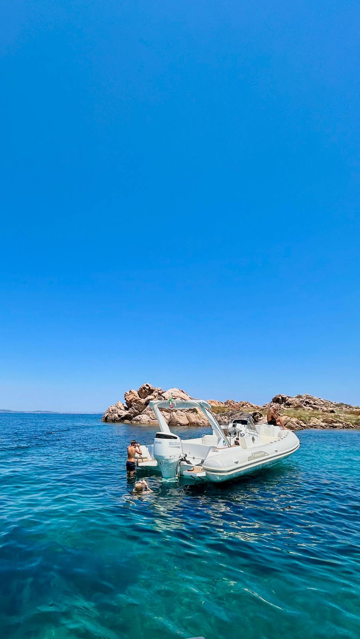
This site's tour leaves the Olbia marina at 9:30 AM and is back at 1:30 PM. Its stops off Tavolara and at Punta Spalmatore are listed for swimming and snorkeling, not for a walk, and it adds Spiaggia del Dottore and a secret stop with an aperitif. If walking on the island matters most to you, the vintage half day from Porto San Paolo lists a stop where guests can go ashore.
In July the island hosts a film festival. Una notte in Italia was founded in 1991, and audiences reach the open-air screenings on boats from Porto San Paolo.4849 Outside festival nights the island is quiet after the last boat leaves, and the best light on the cliffs comes late in the afternoon.
Book your seat
Snorkel off Tavolara this summer
Up to 10 guests, gear included, back in Olbia by 1:30 PM.


You ask,we answer.
What is the height of Tavolara?
560 m. The regional tourism board gives 560 metres, and so does Olbia's tourism portal.19
Who owns Tavolara?
It is mixed. The Bertoleoni descendants, other private owners and the Italian state each hold parts, and access differs.30
Does anyone live on Tavolara?
Sources differ. The protected area says the last residents left after the NATO base was built in 1961; the regional tourism board says the Bertoleoni descendants still live there.650
Can I climb the cliffs?
Not freely. A 2025 ordinance bans climbing except for qualified mountain guides, for study and science.24
Is there food on the island?
At the landing. Spalmatore di Terra has places to eat beside the little port.5
Can I swim anywhere around it?
Not in zone A. Swimming is forbidden in zone A and allowed in zones B and C.51
Which town is it part of?
Olbia. Tavolara, Molara and Molarotto lie in Olbia's municipal territory.8
Sources
Sources and evidence
- 1SardegnaTurismo (Regione Sardegna)Tavolara | SardegnaTurismo - Sito ufficiale del turismo della Regione Sardegna↩
- 2SardegnaTurismo (Regione Sardegna)Tavolara | SardegnaTurismo - Sito ufficiale del turismo della Regione Sardegna↩
- 3SardegnaTurismo (Regione Sardegna)Loiri Porto San Paolo | SardegnaTurismo - Sito ufficiale del turismo della Regione Sardegna↩
- 4SardegnaTurismo (Regione Sardegna)Tavolara | SardegnaTurismo - Sito ufficiale del turismo della Regione Sardegna↩
- 5SardegnaTurismo (Regione Sardegna)Tavolara | SardegnaTurismo - Sito ufficiale del turismo della Regione Sardegna↩
- 6Area Marina Protetta Tavolara Punta Coda CavalloContemporary | Area Marina Protetta Tavolara - Punta Coda Cavallo↩
- 7Area Marina Protetta Tavolara - Punta Coda Cavallo (brochure, PDF)Pieghevole istituzionale 2022↩
- 8Area Marina Protetta Tavolara Punta Coda CavalloOlbia | Area Marina Protetta Tavolara - Punta Coda Cavallo↩
- 9Comune di Olbia - Hello Olbia, official tourism portalSpiagge - Hello Olbia↩
- 10Area Marina Protetta Tavolara Punta Coda CavalloContext | Area Marina Protetta Tavolara - Punta Coda Cavallo↩
- 11Area Marina Protetta Tavolara Punta Coda CavalloContext | Area Marina Protetta Tavolara - Punta Coda Cavallo↩
- 12Area Marina Protetta Tavolara Punta Coda CavalloQuaternary deposits | Area Marina Protetta Tavolara - Punta Coda Cavallo↩
- 13Area Marina Protetta Tavolara Punta Coda CavalloAncient | Area Marina Protetta Tavolara - Punta Coda Cavallo↩
- 14Area Marina Protetta Tavolara Punta Coda CavalloContemporary | Area Marina Protetta Tavolara - Punta Coda Cavallo↩
- 15Area Marina Protetta Tavolara Punta Coda CavalloContemporary | Area Marina Protetta Tavolara - Punta Coda Cavallo↩
- 16Area Marina Protetta Tavolara Punta Coda CavalloThe 3 Towns | Area Marina Protetta Tavolara - Punta Coda Cavallo↩
- 17Area Marina Protetta Tavolara Punta Coda CavalloLimestones | Area Marina Protetta Tavolara - Punta Coda Cavallo↩
- 18Area Marina Protetta Tavolara Punta Coda CavalloGranites | Area Marina Protetta Tavolara - Punta Coda Cavallo↩
- 19SardegnaTurismo (Regione Sardegna)Molara | SardegnaTurismo - Sito ufficiale del turismo della Regione Sardegna↩
- 20SardegnaTurismo (Regione Sardegna)Molara | SardegnaTurismo - Sito ufficiale del turismo della Regione Sardegna↩
- 21Area Marina Protetta Tavolara Punta Coda CavalloTerrestrial Reptiles | Area Marina Protetta Tavolara - Punta Coda Cavallo↩
- 22Area Marina Protetta Tavolara Punta Coda CavalloServices | Area Marina Protetta Tavolara - Punta Coda Cavallo↩
- 23Area Marina Protetta Tavolara Punta Coda CavalloSea birds | Area Marina Protetta Tavolara - Punta Coda Cavallo↩
- 24Comune di OlbiaDivieto di attività di arrampicate a Tavolara per tutelare l'incolumità delle persone e il patrimonio naturalistico - Comune di Olbia↩
- 25SardegnaTurismo (Regione Sardegna)La Cinta | SardegnaTurismo - Sito ufficiale del turismo della Regione Sardegna↩
- 26SardegnaTurismo (Regione Sardegna)Brandinchi | SardegnaTurismo - Sito ufficiale del turismo della Regione Sardegna↩
- 27Transformations journal (article page, HTML)The Kingdom of Tavolara and the Republic of Malu Entu. Micronations, tourism and sub-state nationalism in two Sardinian near islands↩
- 28Area Marina Protetta Tavolara Punta Coda CavalloInformation point of Tavolara | Area Marina Protetta Tavolara - Punta Coda Cavallo↩
- 29Area Marina Protetta Tavolara Punta Coda CavalloServices | Area Marina Protetta Tavolara - Punta Coda Cavallo↩
- 30Marcel A. Farinelli, Transformations journal no. 35 (2021), peer-reviewed; PDF reprint on shimajournal.orgThe Kingdom of Tavolara and the Republic of Malu Entu. Micronations, tourism and sub-state nationalism in two Sardinian near islands↩
- 31SardegnaTurismo (Regione Sardegna)Port of Golfo Aranci | SardegnaTurismo - Sito ufficiale del turismo della Regione Sardegna↩
- 32SardegnaTurismo (Regione Sardegna)Capo Figari and Figarolo island | SardegnaTurismo - Sito ufficiale del turismo della Regione Sardegna↩
- 33Tavolara Traghetti e Gite (ferry operator, own site)Tavolara Traghetti e Gite | Tour nell'Area Marina Protetta di Tavolara↩
- 34SardegnaTurismo (Regione Sardegna)Molara | SardegnaTurismo - Sito ufficiale del turismo della Regione Sardegna↩
- 35SardegnaTurismo (Regione Sardegna)Walking around Gallura | SardegnaTurismo - Sito ufficiale del turismo della Regione Sardegna↩
- 36SardegnaTurismo (Regione Sardegna)Isola Piana - Isola dei Cavalli | SardegnaTurismo - Sito ufficiale del turismo della Regione Sardegna↩
- 37SardegnaTurismo (Regione Sardegna)Isola Piana - Isola dei Cavalli | SardegnaTurismo - Sito ufficiale del turismo della Regione Sardegna↩
- 38SardegnaTurismo (Regione Sardegna)Porto Istana | SardegnaTurismo - Sito ufficiale del turismo della Regione Sardegna↩
- 39Area Marina Protetta Tavolara Punta Coda CavalloCoastal Dunes | Area Marina Protetta Tavolara - Punta Coda Cavallo↩
- 40SardegnaTurismo (Regione Sardegna)Cala Ghjlgolu - della Tartaruga | SardegnaTurismo - Sito ufficiale del turismo della Regione Sardegna↩
- 41Comune di San Teodoro - official beach booking site (santeodorospiagge.it)San Teodoro Spiagge | Il sito dedicato alle spiagge del Comune di San Teodoro↩
- 42SardegnaTurismo (Regione Sardegna)Lu Impostu | SardegnaTurismo - Sito ufficiale del turismo della Regione Sardegna↩
- 43SardegnaTurismo (Regione Sardegna)Capo Coda Cavallo | SardegnaTurismo - Sito ufficiale del turismo della Regione Sardegna↩
- 44Comune di OlbiaDivieto di attività di arrampicate a Tavolara per tutelare l'incolumità delle persone e il patrimonio naturalistico - Comune di Olbia↩
- 45Sezione del Genio Militare per la Marina di Cagliari, design report filed with the Ministero dell'Ambiente (MASE) EIA portal (PDF)Restauration of health and safety conditions to operate the station - Stazione VLF - Isola di Tavolara (OT), Progetto definitivo, Relazione illustrativa↩
- 46Ministero della Difesa (difesa.it)Stazione VLF NATO Tavolara↩
- 47Sezione del Genio Militare per la Marina di Cagliari, design report filed with the Ministero dell'Ambiente (MASE) EIA portal (PDF)Restauration of health and safety conditions to operate the station - Stazione VLF - Isola di Tavolara (OT), Progetto definitivo, Relazione illustrativa↩
- 48Festival del Cinema di Tavolara (Associazione Argonauti, official festival site)Festival Cinema Tavolara 2026 - Festival del Cinema di Tavolara 2026↩
- 49SardegnaTurismo (Regione Sardegna)Tavolara | SardegnaTurismo - Sito ufficiale del turismo della Regione Sardegna↩
- 50SardegnaTurismo (Regione Sardegna)Tavolara | SardegnaTurismo - Sito ufficiale del turismo della Regione Sardegna↩
- 51Ministero dell'Ambiente (MASE) - D.M. 3 dicembre 2014, GU Serie Generale n.6 del 9-1-2015 (PDF)Approvazione del regolamento di esecuzione e organizzazione dell'area marina protetta «Tavolara - Punta Coda Cavallo» (15A00040)↩