Guides
Language
EnglishCurrency
US dollar · $Your currency applies on GetYourGuide too.
Guide · Rules at sea
The Tavolara Marine Protected Area, zone by zone
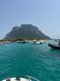
Every boat trip to Tavolara and Molara takes place inside a marine reserve with its own law. Knowing the zones tells you where you can swim, where boats may anchor and why some water stays empty.
Editorial team, tavolaraboattour.comUpdated October 20, 20266-minute read64 sources
Quick answer
What the protected area is and who runs it
The Tavolara Marine Protected Area covers the coast of north-eastern Sardinia from Capo Ceraso to Cala Finocchio and includes the islands of Tavolara, Molara and Molarotto, about 15,000 hectares of sea in all.1 Its full Italian name, Area Marina Protetta Tavolara Punta Coda Cavallo, is the one it uses on its own website and documents.
It was first identified as a reserve by a law of 1982 and established in 1997 by ministerial decree.8 Since 1 January 2004 it has been managed by a consortium of Olbia, Loiri Porto San Paolo and San Teodoro, the towns on its shore.9 Its own count of the sea surface is 15,280 hectares.10
The reserve exists for what lies under the surface: meadows of Posidonia seagrass, coralligenous reefs below 30 metres, groupers and the seabird colonies of the islands.111012 For a visitor it means two things: a sea that is looked after for its wildlife, and a set of rules that every boat, guide and swimmer has to follow. Visitors are part of that picture too, and the reserve runs information points in San Teodoro, Porto San Paolo and on Tavolara, where you can ask about the rules before you head out.13
How the reserve came about
From the first law to the yearly rulebook
-
1982
Identified by law
Law n. 979 of 31 December names the area.8
-
1997
Established
Ministerial decree of 12 December.8
-
2004
Consortium of towns
Olbia, Loiri Porto San Paolo and San Teodoro take over.9
-
2014
Definitive regulation
Regulation n. 299, decreed on 3 December, sets the rules.14
-
2025
Annual rulebook
The Disciplinare is adopted and updated each year.15
Zones A, B and C explained
The rules are set by a definitive regulation, n. 299, issued by the Ministry of the Environment by decree on 3 December 2014.14 It divides the sea into three zones: zone A, the full reserve; zone B, the general reserve; and zone C, the partial reserve.16
Zone A is the strictest. Navigation is not allowed there, and neither is swimming; only the managing body's staff, authorised researchers and guided scuba visits on fixed routes may enter.1732 On the water you will see these areas from a distance, and your skipper will route around them. Think of zone A as the reserve's untouched core: you admire those rocks and islets from a respectful distance, and the rest of the protected sea is still yours to swim in.
Zones B and C are where boat days happen. Swimming is freely allowed there, subject to the orders of the maritime authority, and motor boats may move at no more than 5 knots within 300 metres of the coast and no more than 10 knots between 300 and 600 metres.34 In the stretch of sea off Porto San Paolo every boat keeps to 5 knots or less.18
The zones at a glance
What is allowed in zones A, B and C
| Zone A | Zone B | Zone C | |
|---|---|---|---|
| Swimming and snorkeling | No | Yes | Yes |
| Motor boats | No | 5 knots within 300 m | 5 knots within 300 m |
| Anchoring | No | Sand or pebbles only | Sand or pebbles only |
| Tour boats | No | With a permit | With a permit |
| Watching dolphins | No | Authorised tours | Authorised tours |
From the 2014 regulation and the reserve's zoning page and brochure, read 2026-10-20.1431742262324
Decision helper
Can I do it here?
Common questions on the water, answered by the rules
In the MPA all the allowed and forbidden activities are managed in detail by a definitive regulation (n°299) issued by the Ministero dell’Ambiente e della Tutela del Territorio del Mare, with a decree dated 03/12/2014
Swimming, snorkeling and anchoring
In the regulation, swimming includes the use of a mask and snorkel, fins, boots and gloves, so snorkelers follow exactly the same rules as swimmers.28 Guided snorkeling by professionals is capped: no more than 2 boats at one site at the same time, and no more than 10 people per guide in the water.29
Anchoring is banned anywhere in the reserve on Posidonia meadows, other seagrasses and the coralligenous formations the managers have identified.5 In zones B and C it is allowed only on sandy or pebbly seabeds and in areas specially marked and equipped.6 The services map shows such anchoring zones at the Molara pools for boats up to 30 metres, and at La Cinta and the Spalmatore di Terra for boats up to 40 metres.30
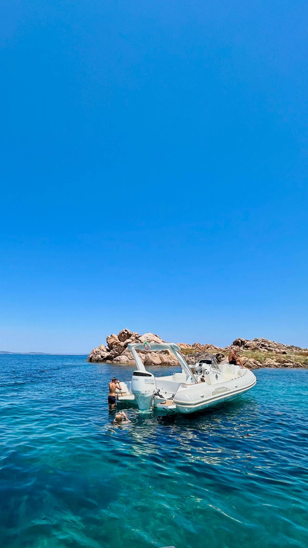
Tour boats often tie up instead of anchoring. The reserve keeps two mooring buoys at Molara and two at Tavolara for operators who carry passengers.31 Inside the mooring fields, diving, anchoring, free navigation and fishing are not allowed.32 If you rent a boat yourself, ask at the rental desk where the buoys and anchoring zones are before you leave, and carry a mooring line long enough to reach a buoy.
Map
Tavolara, Molara and the coast from Olbia to San Teodoro
Where the boats leave from, the islands and their landing places, and the beaches that face them.
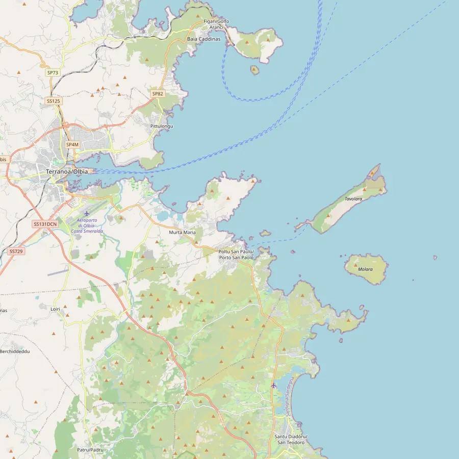 1Olbia marina2Golfo Aranci3Figarolo4Porto San Paolo5Tavolara6Molara7San Teodoro8Capo Ceraso
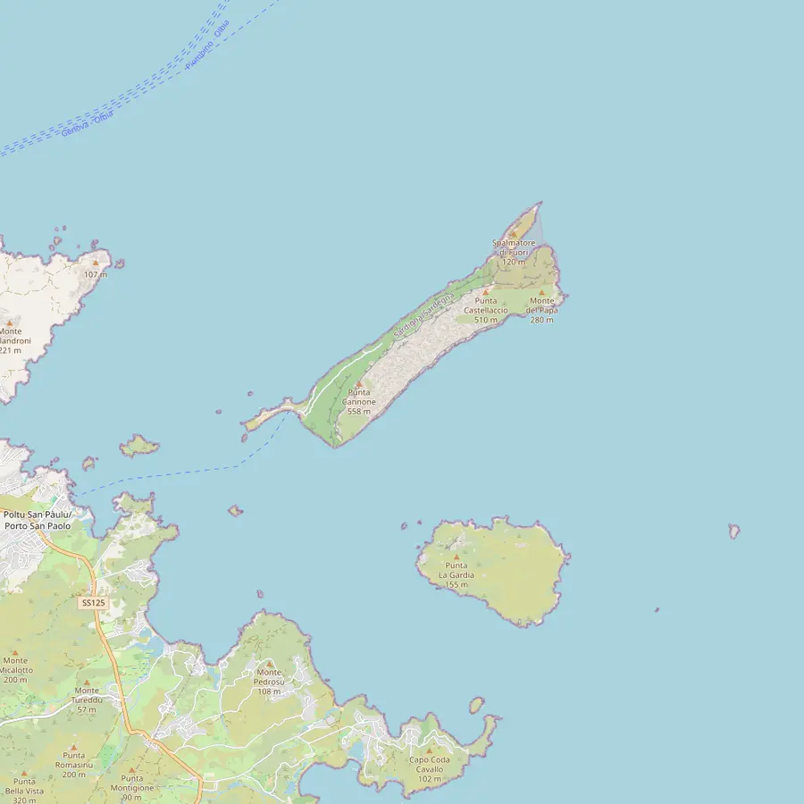 9Spalmatore di Terra10Punta Cannone11Punta Timone12Piscine di Molara13Molarotto14Isola Piana15Isola dei Cavalli
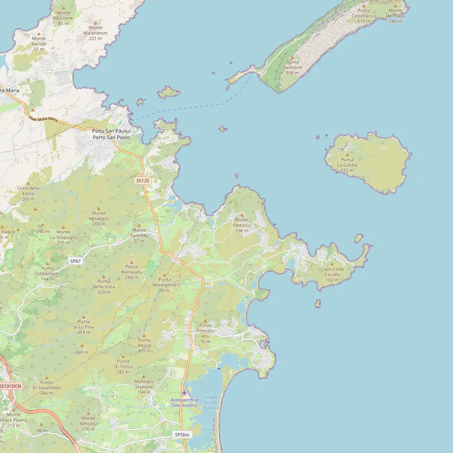 16Spiaggia del Dottore17Porto Istana18Porto Taverna19Cala Girgolu20Cala Brandinchi21Lu Impostu22Capo Coda Cavallo23La Cinta
- 1Olbia marina (MOYS)
This site's tour checks in here at Dock A, Berth A44, and several other boats to the islands leave from the same marina.
In Google Maps ↗ - 2Golfo Aranci
A port 20 minutes from Olbia, facing Tavolara, where dolphin trips and some island boats start.33
In Google Maps ↗ - 3Figarolo
A pyramid-shaped limestone islet off Cala Moresca, where the dolphin trips look for a pod of bottlenose dolphins.34
In Google Maps ↗ - 4Porto San Paolo
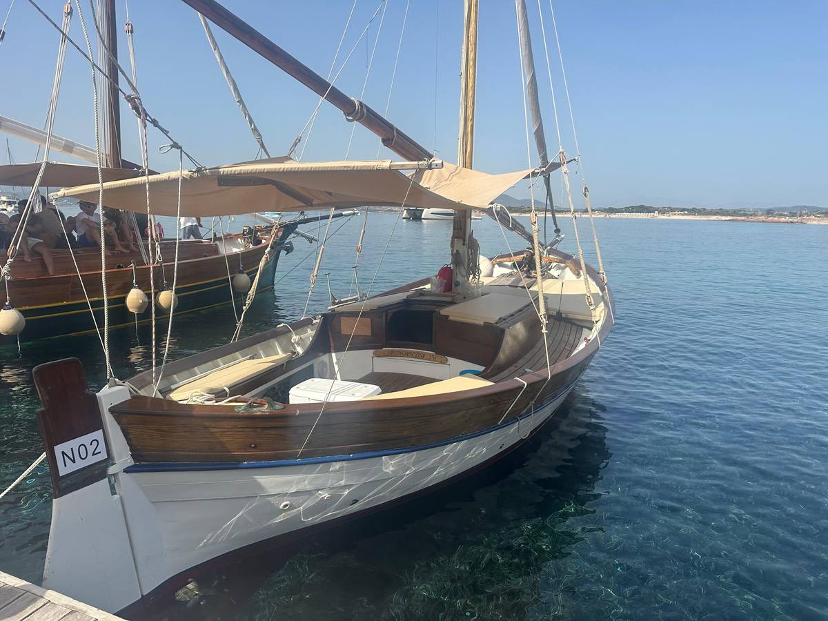
The village opposite the island: the ferry office is in Via Molara, and wooden boats leave from the floating docks.35
In Google Maps ↗ - 5Tavolara
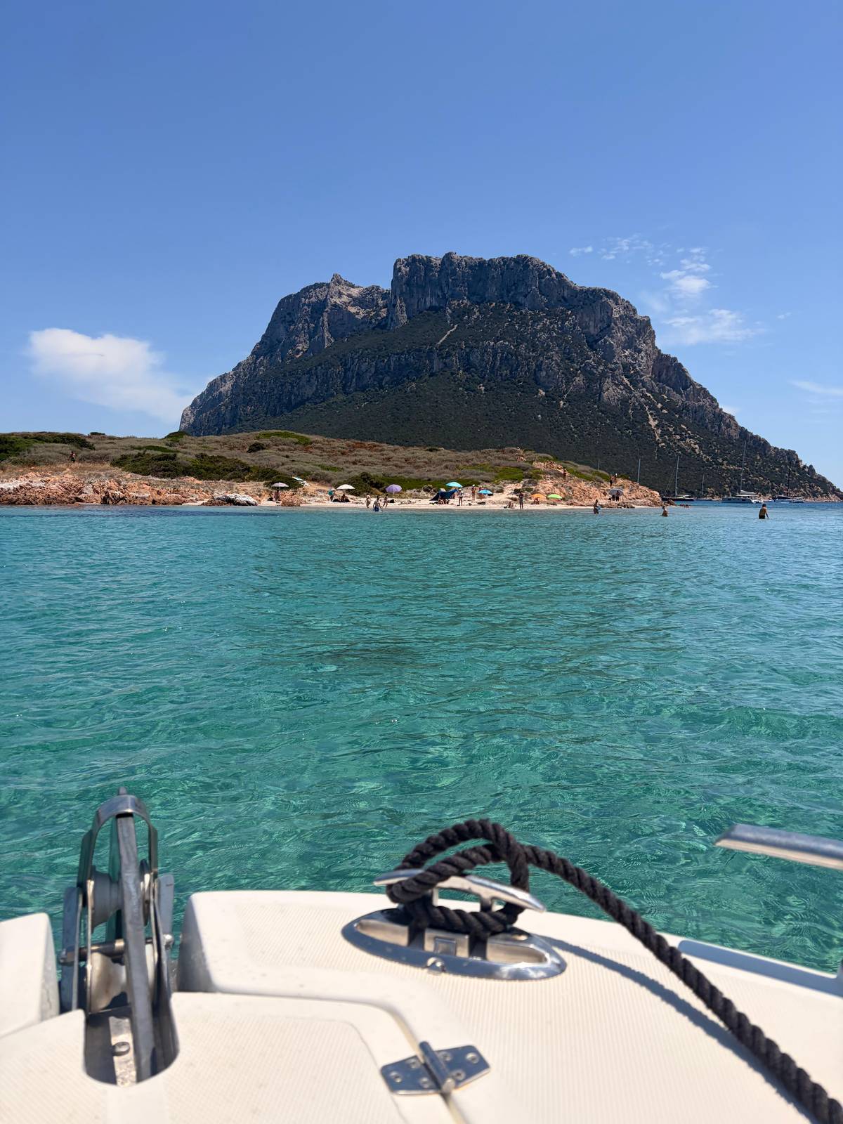
A limestone and granite mountain rising from the sea, 560 m high and 4 km long, in Olbia's territory.3637
In Google Maps ↗ - 6Molara
The second largest island of the protected area, uninhabited, with its pools on the south-west side.3839
In Google Maps ↗ - 7San Teodoro
The harbor where the dinghy tours of the archipelago set off each morning.
In Google Maps ↗ - 8Capo Ceraso
A headland passed on the way out from Olbia; a disused military road leads to its old fortifications.40
In Google Maps ↗ - 9Spalmatore di Terra
The landing place, with a little port, places to eat, a few houses and the protected area's info point.4142
In Google Maps ↗ - 10Punta Cannone
The summit, reached by a guided trek and a short via ferrata; climbing on the island has been restricted since 2025, so ask the operator first.
In Google Maps ↗ - 11Punta Timone
Site of the NATO radio station built in 1961; the protected area's map marks a military area with no entry.4344
In Google Maps ↗ - 12Piscine di Molara
Clear pools among granite rocks, with an anchoring zone for boats up to 30 m.3930
In Google Maps ↗ - 13Molarotto
A small granite rock in the integral reserve, home to a lizard subspecies found nowhere else.45
In Google Maps ↗ - 14Isola Piana
An island off Porto San Paolo with little beaches of fine greyish sand.46
In Google Maps ↗ - 15Isola dei Cavalli
A small island with a beach of fine, firm sand and shallow water.47
In Google Maps ↗ - 16Spiaggia del Dottore
The first swim stop of this site's tour and of several other boats.
In Google Maps ↗ - 17Porto Istana
A bay of four beaches at the foot of Capo Ceraso, twenty minutes by car from Olbia.48
In Google Maps ↗ - 18Porto Taverna
Dunes with a pond behind them, where water birds can be seen.49
In Google Maps ↗ - 19Cala Girgolu
Known for the turtle-shaped rock called La Tartaruga.50
In Google Maps ↗ - 20Cala Brandinchi
Very light sand and turquoise water almost opposite the island; access is booked from 1 June to 30 September.5152
In Google Maps ↗ - 21Lu Impostu
One kilometre of white sand dunes with junipers, the twin of Brandinchi.53
In Google Maps ↗ - 22Capo Coda Cavallo
A strip of granite land sheltered by Tavolara, with Molara and the islet of Proratora in front.54
In Google Maps ↗ - 23La Cinta
San Teodoro's most famous beach, an arch of fine white sand facing the island.55
In Google Maps ↗
Checklist
Behaving in the reserve
Do
- Swim only where your skipper stops
- Take all your rubbish home
- Report animals in distress to the reserve
Do not
- Touch, feed or take anything from the sea
- Anchor over seagrass if you rent a boat
- Approach the military zone
Video
A dive into the waters of the "Tavolara - Punta Coda Cavallo" Marine Protected Area
Nothing loads from YouTube until you press play.
Limits on tour boats and rental boats
Passenger and guided-tour boats may not enter zone A, and they need a specific permit from the managing body to work in zones B and C.23 They may moor, with that permit, only to buoys placed to protect the seabed.56
There are also caps on numbers. Each licensed tour boat may carry no more than 100 passengers, and the 2014 regulation fixes the total carried each day on authorised passenger boats at 800 people.1920 For rental and charter boats, the 2025 rulebook sets a daily total of 1,923 people.21 That rulebook is adopted and updated every year, so check the current edition if you plan to hire a boat.15
For a guest on a tour none of this needs any action: your operator holds the permits and knows the limits. It is worth knowing, though, when a skipper waits for a free buoy instead of dropping anchor wherever there is space: that is the rule at work, not a delay.
Dolphins and whales: the watching code
Bottlenose dolphins are seen often in the reserve, according to San Teodoro's tourism office, and Risso's dolphins and sperm whales have also been sighted.57 The regulation bans whale and dolphin watching in zone A and allows it in zones B and C only with the managing body's authorisation, aboard guided-tour boats.24
Around any cetacean it draws two bands: an observation band within 100 metres and an approach band within 300 metres.58 Boats may not come closer than 100 metres, swimming is not allowed in the observation band, and no boat may stay there more than 20 minutes.2526 Speed in both bands is limited to 5 knots.59
Feeding the animals, throwing anything into the water and approaching them head-on are all forbidden.60 If you see a turtle or a dolphin in distress, call the reserve on 0789/203013, or the emergency numbers 1530 or 1515.61
The military zone at Punta Timone
Part of the island is closed for another reason. In 1961 a NATO military base was built at Punta Timone, and the last residents of the island had to leave because of it.43 The Ministry of Defence lists the unit as the Stazione VLF NATO Tavolara.62
The reserve's own map marks a military area with no entry under an ordinance of Olbia's Coast Guard from 1967.63 A Navy report states that the easement zone is off-limits to tourists and bathers and that approaching it by any means is strictly forbidden.27 Because there are military installations in the protected area, the reserve's rules may be specifically waived to balance protection of the environment with the defence of the State.64
Tour skippers know these lines, so on a booked trip there is nothing to do. If you hire a boat, ask the rental company to mark the restricted water on a chart and stay well away from it. A good chart from the rental desk, a phone with an offline map and a cautious margin are all you need to stay on the right side of the line.
Book your seat
Snorkel off Tavolara this summer
Up to 10 guests, gear included, back in Olbia by 1:30 PM.


You ask,we answer.
Can I swim anywhere in the reserve?
Not in zone A. Swimming is forbidden in zone A and freely allowed in zones B and C.3
Does snorkeling count as swimming?
Yes. The regulation includes mask and snorkel, fins, boots and gloves in swimming.28
How fast may boats go?
5 knots near the coast. Within 300 m of the coast 5 knots, from 300 to 600 m 10 knots, in zones B and C.4
Can I anchor at the Molara pools?
In the marked zone. The services map shows an anchoring zone there for boats up to 30 m.30
Are jet skis allowed?
No. Jet skis, water scooters and towed water sports are banned throughout the reserve.7
Who manages the reserve?
A consortium of towns. Olbia, Loiri Porto San Paolo and San Teodoro, since 1 January 2004.9
How close may a boat get to dolphins?
No closer than 100 m. And no more than 20 minutes in the observation band.2526
Can I visit the NATO site?
No. The military zone is off-limits and approaching it by any means is forbidden.27
Sources
Sources and evidence
- 1Area Marina Protetta Tavolara Punta Coda CavalloThe 3 Towns | Area Marina Protetta Tavolara - Punta Coda Cavallo↩
- 2Area Marina Protetta Tavolara Punta Coda CavalloPieghevole istituzionale 2022↩
- 3Ministero dell'Ambiente (MASE) - D.M. 3 dicembre 2014, GU Serie Generale n.6 del 9-1-2015 (PDF)Approvazione del regolamento di esecuzione e organizzazione dell'area marina protetta «Tavolara - Punta Coda Cavallo» (15A00040)↩
- 4Ministero dell'Ambiente (MASE) - D.M. 3 dicembre 2014, GU Serie Generale n.6 del 9-1-2015 (PDF)Approvazione del regolamento di esecuzione e organizzazione dell'area marina protetta «Tavolara - Punta Coda Cavallo» (15A00040)↩
- 5Ministero dell'Ambiente (MASE) - D.M. 3 dicembre 2014, GU Serie Generale n.6 del 9-1-2015 (PDF)Approvazione del regolamento di esecuzione e organizzazione dell'area marina protetta «Tavolara - Punta Coda Cavallo» (15A00040)↩
- 6Area Marina Protetta Tavolara Punta Coda CavalloZonizzazione | Area Marina Protetta Tavolara - Punta Coda Cavallo↩
- 7Ministero dell'Ambiente (MASE) - D.M. 3 dicembre 2014, GU Serie Generale n.6 del 9-1-2015 (PDF)Approvazione del regolamento di esecuzione e organizzazione dell'area marina protetta «Tavolara - Punta Coda Cavallo» (15A00040)↩
- 8Area Marina Protetta Tavolara Punta Coda CavalloThe 3 Towns | Area Marina Protetta Tavolara - Punta Coda Cavallo↩
- 9Area Marina Protetta Tavolara Punta Coda CavalloThe 3 Towns | Area Marina Protetta Tavolara - Punta Coda Cavallo↩
- 10Area Marina Protetta Tavolara Punta Coda CavalloCoralligenous | Area Marina Protetta Tavolara - Punta Coda Cavallo↩
- 11Area Marina Protetta Tavolara Punta Coda CavalloPosidonia oceanica prairie | Area Marina Protetta Tavolara - Punta Coda Cavallo↩
- 12Area Marina Protetta Tavolara Punta Coda CavalloFishes | Area Marina Protetta Tavolara - Punta Coda Cavallo↩
- 13Area Marina Protetta Tavolara Punta Coda CavalloServices | Area Marina Protetta Tavolara - Punta Coda Cavallo↩
- 14Area Marina Protetta Tavolara Punta Coda CavalloZoning | Area Marina Protetta Tavolara - Punta Coda Cavallo↩
- 15Consorzio di Gestione AMP Tavolara - Punta Coda Cavallo (PDF)Disciplinare integrativo al Regolamento di esecuzione e organizzazione dell'AMP di Tavolara Punta Coda Cavallo, 2025↩
- 16Area Marina Protetta Tavolara Punta Coda CavalloPieghevole istituzionale 2022↩
- 17Ministero dell'Ambiente (MASE) - D.M. 3 dicembre 2014, GU Serie Generale n.6 del 9-1-2015 (PDF)Approvazione del regolamento di esecuzione e organizzazione dell'area marina protetta «Tavolara - Punta Coda Cavallo» (15A00040)↩
- 18Ministero dell'Ambiente (MASE) - D.M. 3 dicembre 2014, GU Serie Generale n.6 del 9-1-2015 (PDF)Approvazione del regolamento di esecuzione e organizzazione dell'area marina protetta «Tavolara - Punta Coda Cavallo» (15A00040)↩
- 19Ministero dell'Ambiente (MASE) - D.M. 3 dicembre 2014, GU Serie Generale n.6 del 9-1-2015 (PDF)Approvazione del regolamento di esecuzione e organizzazione dell'area marina protetta «Tavolara - Punta Coda Cavallo» (15A00040)↩
- 20Ministero dell'Ambiente (MASE) - D.M. 3 dicembre 2014, GU Serie Generale n.6 del 9-1-2015 (PDF)Approvazione del regolamento di esecuzione e organizzazione dell'area marina protetta «Tavolara - Punta Coda Cavallo» (15A00040)↩
- 21Consorzio di Gestione AMP Tavolara - Punta Coda Cavallo (PDF)Disciplinare integrativo al Regolamento di esecuzione e organizzazione dell'AMP di Tavolara Punta Coda Cavallo, 2025↩
- 22Ministero dell'Ambiente (MASE) - D.M. 3 dicembre 2014, GU Serie Generale n.6 del 9-1-2015 (PDF)Approvazione del regolamento di esecuzione e organizzazione dell'area marina protetta «Tavolara - Punta Coda Cavallo» (15A00040)↩
- 23Ministero dell'Ambiente (MASE) - D.M. 3 dicembre 2014, GU Serie Generale n.6 del 9-1-2015 (PDF)Approvazione del regolamento di esecuzione e organizzazione dell'area marina protetta «Tavolara - Punta Coda Cavallo» (15A00040)↩
- 24Ministero dell'Ambiente (MASE) - D.M. 3 dicembre 2014, GU Serie Generale n.6 del 9-1-2015 (PDF)Approvazione del regolamento di esecuzione e organizzazione dell'area marina protetta «Tavolara - Punta Coda Cavallo» (15A00040)↩
- 25Ministero dell'Ambiente (MASE) - D.M. 3 dicembre 2014, GU Serie Generale n.6 del 9-1-2015 (PDF)Approvazione del regolamento di esecuzione e organizzazione dell'area marina protetta «Tavolara - Punta Coda Cavallo» (15A00040)↩
- 26Ministero dell'Ambiente (MASE) - D.M. 3 dicembre 2014, GU Serie Generale n.6 del 9-1-2015 (PDF)Approvazione del regolamento di esecuzione e organizzazione dell'area marina protetta «Tavolara - Punta Coda Cavallo» (15A00040)↩
- 27Sezione del Genio Militare per la Marina di Cagliari, design report filed with the Ministero dell'Ambiente (MASE) EIA portal (PDF)Restauration of health and safety conditions to operate the station - Stazione VLF - Isola di Tavolara (OT), Progetto definitivo, Relazione illustrativa↩
- 28Ministero dell'Ambiente (MASE) - D.M. 3 dicembre 2014, GU Serie Generale n.6 del 9-1-2015 (PDF)Approvazione del regolamento di esecuzione e organizzazione dell'area marina protetta «Tavolara - Punta Coda Cavallo» (15A00040)↩
- 29Ministero dell'Ambiente (MASE) - D.M. 3 dicembre 2014, GU Serie Generale n.6 del 9-1-2015 (PDF)Approvazione del regolamento di esecuzione e organizzazione dell'area marina protetta «Tavolara - Punta Coda Cavallo» (15A00040)↩
- 30Area Marina Protetta Tavolara Punta Coda CavalloServices | Area Marina Protetta Tavolara - Punta Coda Cavallo↩
- 31Consorzio di Gestione AMP Tavolara - Punta Coda Cavallo (PDF)Disciplinare integrativo al Regolamento di esecuzione e organizzazione dell'AMP di Tavolara Punta Coda Cavallo, 2025↩
- 32Ministero dell'Ambiente (MASE) - D.M. 3 dicembre 2014, GU Serie Generale n.6 del 9-1-2015 (PDF)Approvazione del regolamento di esecuzione e organizzazione dell'area marina protetta «Tavolara - Punta Coda Cavallo» (15A00040)↩
- 33SardegnaTurismo (Regione Sardegna)Port of Golfo Aranci | SardegnaTurismo - Sito ufficiale del turismo della Regione Sardegna↩
- 34SardegnaTurismo (Regione Sardegna)Capo Figari and Figarolo island | SardegnaTurismo - Sito ufficiale del turismo della Regione Sardegna↩
- 35Tavolara Traghetti e Gite (ferry operator, own site)Tavolara Traghetti e Gite | Tour nell'Area Marina Protetta di Tavolara↩
- 36SardegnaTurismo (Regione Sardegna)Tavolara | SardegnaTurismo - Sito ufficiale del turismo della Regione Sardegna↩
- 37SardegnaTurismo (Regione Sardegna)Tavolara | SardegnaTurismo - Sito ufficiale del turismo della Regione Sardegna↩
- 38SardegnaTurismo (Regione Sardegna)Molara | SardegnaTurismo - Sito ufficiale del turismo della Regione Sardegna↩
- 39SardegnaTurismo (Regione Sardegna)Molara | SardegnaTurismo - Sito ufficiale del turismo della Regione Sardegna↩
- 40SardegnaTurismo (Regione Sardegna)Walking around Gallura | SardegnaTurismo - Sito ufficiale del turismo della Regione Sardegna↩
- 41SardegnaTurismo (Regione Sardegna)Tavolara | SardegnaTurismo - Sito ufficiale del turismo della Regione Sardegna↩
- 42Area Marina Protetta Tavolara Punta Coda CavalloServices | Area Marina Protetta Tavolara - Punta Coda Cavallo↩
- 43Area Marina Protetta Tavolara Punta Coda CavalloContemporary | Area Marina Protetta Tavolara - Punta Coda Cavallo↩
- 44Area Marina Protetta Tavolara - Punta Coda Cavallo (brochure, PDF)Pieghevole istituzionale 2022↩
- 45Area Marina Protetta Tavolara Punta Coda CavalloTerrestrial Reptiles | Area Marina Protetta Tavolara - Punta Coda Cavallo↩
- 46SardegnaTurismo (Regione Sardegna)Isola Piana - Isola dei Cavalli | SardegnaTurismo - Sito ufficiale del turismo della Regione Sardegna↩
- 47SardegnaTurismo (Regione Sardegna)Isola Piana - Isola dei Cavalli | SardegnaTurismo - Sito ufficiale del turismo della Regione Sardegna↩
- 48SardegnaTurismo (Regione Sardegna)Porto Istana | SardegnaTurismo - Sito ufficiale del turismo della Regione Sardegna↩
- 49Area Marina Protetta Tavolara Punta Coda CavalloCoastal Dunes | Area Marina Protetta Tavolara - Punta Coda Cavallo↩
- 50SardegnaTurismo (Regione Sardegna)Cala Ghjlgolu - della Tartaruga | SardegnaTurismo - Sito ufficiale del turismo della Regione Sardegna↩
- 51SardegnaTurismo (Regione Sardegna)Brandinchi | SardegnaTurismo - Sito ufficiale del turismo della Regione Sardegna↩
- 52Comune di San Teodoro - official beach booking site (santeodorospiagge.it)San Teodoro Spiagge | Il sito dedicato alle spiagge del Comune di San Teodoro↩
- 53SardegnaTurismo (Regione Sardegna)Lu Impostu | SardegnaTurismo - Sito ufficiale del turismo della Regione Sardegna↩
- 54SardegnaTurismo (Regione Sardegna)Capo Coda Cavallo | SardegnaTurismo - Sito ufficiale del turismo della Regione Sardegna↩
- 55SardegnaTurismo (Regione Sardegna)La Cinta | SardegnaTurismo - Sito ufficiale del turismo della Regione Sardegna↩
- 56Ministero dell'Ambiente (MASE) - D.M. 3 dicembre 2014, GU Serie Generale n.6 del 9-1-2015 (PDF)Approvazione del regolamento di esecuzione e organizzazione dell'area marina protetta «Tavolara - Punta Coda Cavallo» (15A00040)↩
- 57Comune di San Teodoro (santeodoroturismo.it, official tourism site)Area Marina Protetta - San Teodoro↩
- 58Ministero dell'Ambiente (MASE) - D.M. 3 dicembre 2014, GU Serie Generale n.6 del 9-1-2015 (PDF)Approvazione del regolamento di esecuzione e organizzazione dell'area marina protetta «Tavolara - Punta Coda Cavallo» (15A00040)↩
- 59Ministero dell'Ambiente (MASE) - D.M. 3 dicembre 2014, GU Serie Generale n.6 del 9-1-2015 (PDF)Approvazione del regolamento di esecuzione e organizzazione dell'area marina protetta «Tavolara - Punta Coda Cavallo» (15A00040)↩
- 60Ministero dell'Ambiente (MASE) - D.M. 3 dicembre 2014, GU Serie Generale n.6 del 9-1-2015 (PDF)Approvazione del regolamento di esecuzione e organizzazione dell'area marina protetta «Tavolara - Punta Coda Cavallo» (15A00040)↩
- 61Area Marina Protetta Tavolara Punta Coda CavalloSea Fauna at risk | Area Marina Protetta Tavolara - Punta Coda Cavallo↩
- 62Ministero della Difesa (difesa.it)Stazione VLF NATO Tavolara↩
- 63Area Marina Protetta Tavolara Punta Coda CavalloPieghevole istituzionale 2022↩
- 64Ministero dell'Ambiente (MASE) - D.M. 3 dicembre 2014, GU Serie Generale n.6 del 9-1-2015 (PDF)Approvazione del regolamento di esecuzione e organizzazione dell'area marina protetta «Tavolara - Punta Coda Cavallo» (15A00040)↩